NASA Image Captures Dramatic Tidal Shifts Across Guinea-Bissau's Bijagós Archipelago
0
·36 views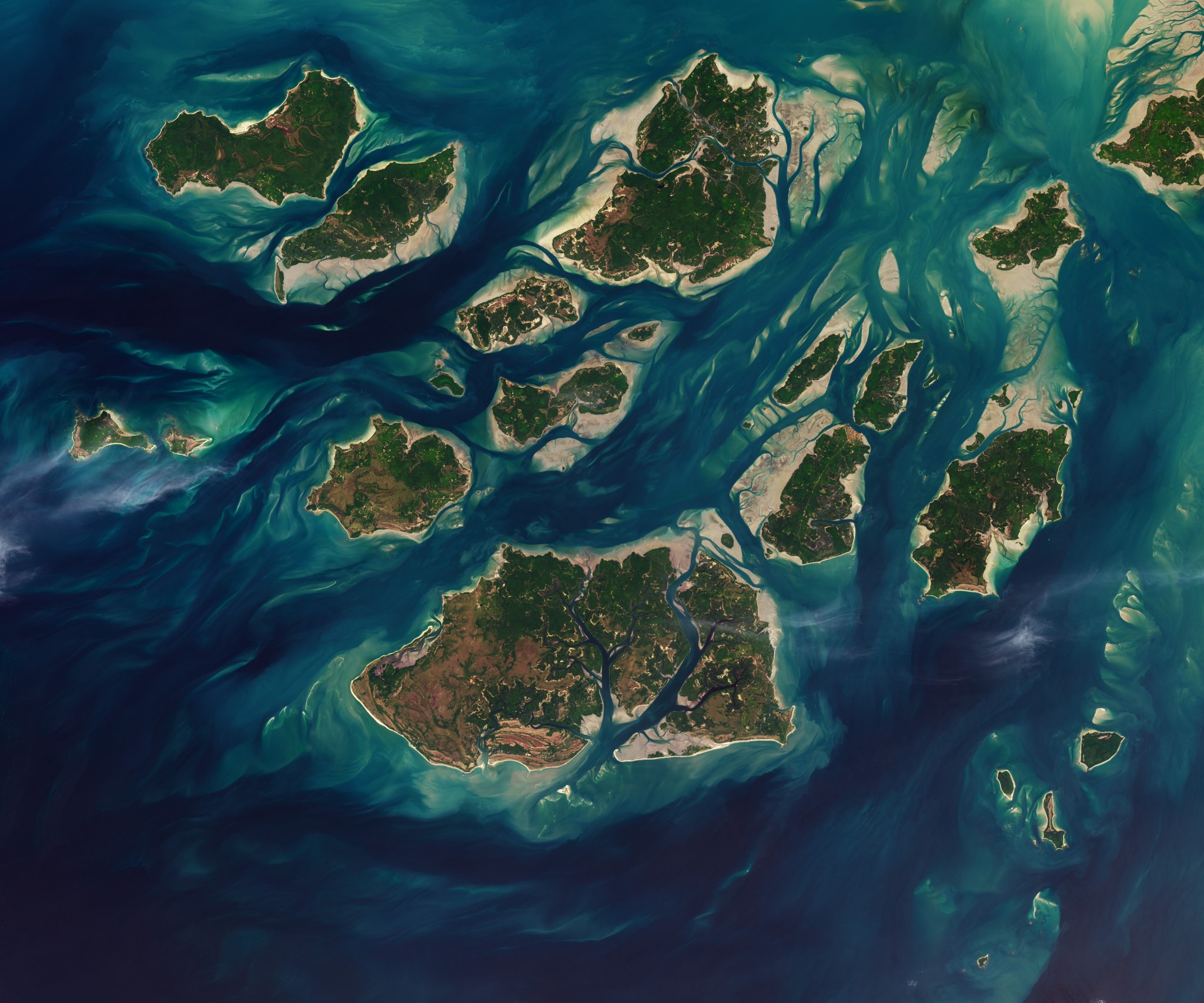
A NASA satellite image captured on November 28, 2025, reveals the striking tidal dynamics of Guinea-Bissau's Bijagós Archipelago. The archipelago comprises 88 islands and islets bordered by a complex network of sandy channels, mudflats, and mangrove forests. Tides cycle twice daily through this intricate coastal landscape, producing dramatic visual transformations visible from space. At low tide, expansive intertidal mudflats and sandflats are exposed, sharply altering the appearance of the terrain.
This is an AI-generated summary. ShortSingh links to the original source for the complete article.




Discussion (0)
Log in to join the discussion and vote.
Log in