NISAR Satellite Maps Ground Shifts From Venezuela's June 2026 Earthquakes
0
·27 views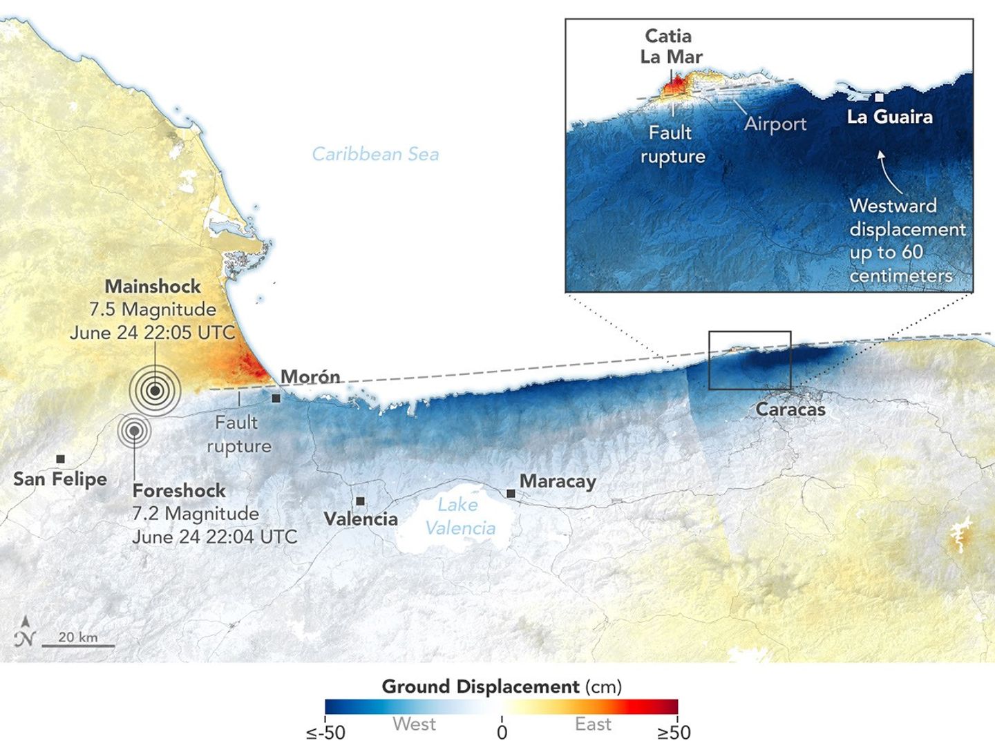
A series of earthquakes struck Venezuela in June 2026, causing notable ground displacement in affected regions. NASA's NISAR satellite captured radar data revealing the extent of surface shifts caused by the tremors. The coastal city of La Guaira and surrounding areas were among the most visibly impacted zones. The satellite imagery provides scientists with precise measurements of how much the ground moved during the seismic events.
This is an AI-generated summary. ShortSingh links to the original source for the complete article.


Discussion (0)
Log in to join the discussion and vote.
Log in